Weather Alert in Ohio
Flood Advisory issued April 29 at 7:52PM EDT until April 29 at 10:45PM EDT by NWS Wilmington OH
AREAS AFFECTED: Clermont, OH; Hamilton, OH; Warren, OH
DESCRIPTION: * WHAT...Flooding caused by excessive rainfall is expected. * WHERE...The following counties, in southwest Ohio, Clermont, Hamilton and Warren. * WHEN...Until 1045 PM EDT. * IMPACTS...Minor flooding in low-lying and poor drainage areas. * ADDITIONAL DETAILS... - At 752 PM EDT, radar indicated heavy rain due to thunderstorms. Minor flooding is ongoing or expected to begin shortly in the advisory area. Between 1 and 1.5 inches of rain have fallen. Additional rainfall amounts of 0.5 to 1 inch are possible. - Some locations that may experience flooding include... Cincinnati, Blue Ash, Loveland, Reading, Montgomery, Madeira, Milford, Deer Park, Blanchester, Mariemont, Terrace Park, Camp Dennison, Remington, Sixteen Mile Stand, Concorde Hills, Rossmoyne, Plainville, The Village of Indian Hill, Silverton and Golf Manor.
INSTRUCTION: Turn around, don't drown when encountering flooded roads. Most flood deaths occur in vehicles. To report flooding, go to our website at weather.gov/iln and submit your report via social media, when you can do so safely.
Want more detail? Get the Complete 7 Day and Night Detailed Forecast!
Current U.S. National Radar--Current
The Current National Weather Radar is shown below with a UTC Time (subtract 5 hours from UTC to get Eastern Time).

National Weather Forecast--Current
The Current National Weather Forecast and National Weather Map are shown below.

National Weather Forecast for Tomorrow
Tomorrow National Weather Forecast and Tomorrow National Weather Map are show below.

North America Water Vapor (Moisture)
This map shows recent moisture content over North America. Bright and colored areas show high moisture (ie, clouds); brown indicates very little moisture present; black indicates no moisture.

Weather Topic: What are Cumulonimbus Clouds?
Home - Education - Cloud Types - Cumulonimbus Clouds
 Next Topic: Cumulus Clouds
The final form taken by a growing cumulus cloud is the
cumulonimbus cloud, which is very tall and dense.
The tower of a cumulonimbus cloud can soar 23 km into the atmosphere, although
most commonly they stop growing at an altitude of 6 km.
Even small cumulonimbus clouds appear very large in comparison to other cloud types.
They can signal the approach of stormy weather, such as thunderstorms or blizzards.
Next Topic: Cumulus Clouds
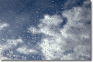
Weather Topic: What is Drizzle?
Home - Education - Precipitation - Drizzle
 Next Topic: Evaporation
Drizzle is precipitation in the form of water droplets which are
smaller than raindrops.
Drizzle is characterized by fine, gently falling droplets and typically does not
impact human habitation in a negative way. The exception to this is freezing drizzle,
a condition where drizzle freezes immediately upon reaching earth's surface.
Freezing drizzle is still less dangerous than freezing rain, but can
potentially result in hazardous road conditions.
Next Topic: Evaporation
Current conditions powered by WeatherAPI.com


