Weather Alert in Indiana
Flood Warning issued March 4 at 3:57AM EST until March 6 at 4:37PM EST by NWS Indianapolis IN
AREAS AFFECTED: Shelby, IN
DESCRIPTION: ...The National Weather Service in Indianapolis IN has issued a Flood Warning for the following rivers in Indiana... Big Blue River at Shelbyville. Driftwood River near Edinburgh. Flatrock River near Columbus. East Fork White River at Columbus. White River at Spencer. Eel River at Bowling Green. ...Forecast flooding changed from Minor to Moderate severity and increased in duration for the following rivers in Indiana... East Fork White River at Seymour. .Between 2 and 4 inches of rain have fallen across central Indiana as of early Wednesday morning. Up to 2 inches have fallen in south-central Indiana. This has led creeks to rise above flood stage and rivers will follow in the coming days. Additional rain is in the forecast over the next several days. * WHAT...Minor flooding is forecast. * WHERE...Big Blue River at Shelbyville. * WHEN...From this afternoon to Friday afternoon. * IMPACTS...At 14.0 feet, Flooding begins to affect business and residential property. West Washington Avenue east of rendering plant begins to flood. In winter and spring, persons are not too concerned. This level is rather unusual for summer. * ADDITIONAL DETAILS... - At 2:45 AM EST Wednesday the stage was 10.5 feet. - Forecast...The river will rise above flood stage this afternoon to 13.8 feet this evening. It will then fall below flood stage early Friday morning. - Flood stage is 13.0 feet. - http://www.weather.gov/safety/flood
INSTRUCTION: Motorists should not attempt to drive around barricades or drive cars through flooded areas. Additional information is available at www.weather.gov/ind. The next statement should be issued this evening by around 700 PM EST.
Want more detail? Get the Complete 7 Day and Night Detailed Forecast!
Current U.S. National Radar--Current
The Current National Weather Radar is shown below with a UTC Time (subtract 5 hours from UTC to get Eastern Time).

National Weather Forecast--Current
The Current National Weather Forecast and National Weather Map are shown below.

National Weather Forecast for Tomorrow
Tomorrow National Weather Forecast and Tomorrow National Weather Map are show below.

North America Water Vapor (Moisture)
This map shows recent moisture content over North America. Bright and colored areas show high moisture (ie, clouds); brown indicates very little moisture present; black indicates no moisture.

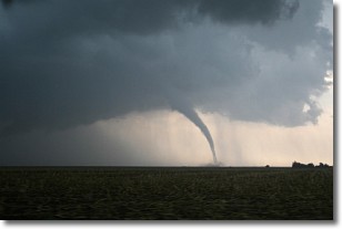
Weather Topic: What are Wall Clouds?
Home - Education - Cloud Types - Wall Clouds
 Next Topic: Altocumulus Clouds
A wall cloud forms underneath the base of a cumulonimbus cloud,
and can be a hotbed for deadly tornadoes.
Wall clouds are formed by air flowing into the cumulonimbus clouds, which can
result in the wall cloud descending from the base of the cumulonimbus cloud, or
rising fractus clouds which join to the base of the storm cloud as the wall cloud
takes shape.
Wall clouds can be very large, and in the Northern Hemisphere they generally
form at the southern edge of cumulonimbus clouds.
Next Topic: Altocumulus Clouds
Weather Topic: What are Altostratus Clouds?
Home - Education - Cloud Types - Altostratus Clouds
 Next Topic: Cirrocumulus Clouds
Altostratus clouds form at mid to high-level altitudes
(between 2 and 7 km) and are created by a warm, stable air mass which causes
water vapor
to condense as it rise through the atmosphere. Usually altostratus clouds are
featureless sheets characterized by a uniform color.
In some cases, wind punching through the cloud formation may give it a waved
appearance, called altostratus undulatus. Altostratus clouds
are commonly seen with other cloud formations accompanying them.
Next Topic: Cirrocumulus Clouds
Current conditions powered by WeatherAPI.com


