Weather Alert in Texas
Severe Thunderstorm Warning issued April 29 at 3:55PM CDT until April 29 at 5:00PM CDT by NWS Midland/Odessa TX
AREAS AFFECTED: Crane, TX; Pecos, TX; Upton, TX
DESCRIPTION: SVRMAF The National Weather Service in Midland has issued a * Severe Thunderstorm Warning for... Northeastern Pecos County in southwestern Texas... Southeastern Crane County in western Texas... Southern Upton County in western Texas... * Until 500 PM CDT. * At 354 PM CDT, severe thunderstorms were located along a line extending from near McCamey to 19 miles southwest of Rankin to 30 miles south of Crane, moving east at 15 mph. HAZARD...Golf ball size hail and 70 mph wind gusts. SOURCE...Radar indicated. IMPACT...People and animals outdoors will be injured. Expect hail damage to roofs, siding, windows, and vehicles. Expect considerable tree damage. Wind damage is also likely to mobile homes, roofs, and outbuildings. * Locations impacted include... McCamey, Rankin, Iraan, Upton County Airport, and Girvin.
INSTRUCTION: Prepare immediately for large hail and damaging winds. People outside should move immediately to shelter inside a strong building. Stay away from windows.
Want more detail? Get the Complete 7 Day and Night Detailed Forecast!
Current U.S. National Radar--Current
The Current National Weather Radar is shown below with a UTC Time (subtract 5 hours from UTC to get Eastern Time).

National Weather Forecast--Current
The Current National Weather Forecast and National Weather Map are shown below.

National Weather Forecast for Tomorrow
Tomorrow National Weather Forecast and Tomorrow National Weather Map are show below.

North America Water Vapor (Moisture)
This map shows recent moisture content over North America. Bright and colored areas show high moisture (ie, clouds); brown indicates very little moisture present; black indicates no moisture.

Weather Topic: What are Cumulonimbus Clouds?
Home - Education - Cloud Types - Cumulonimbus Clouds
 Next Topic: Cumulus Clouds
The final form taken by a growing cumulus cloud is the
cumulonimbus cloud, which is very tall and dense.
The tower of a cumulonimbus cloud can soar 23 km into the atmosphere, although
most commonly they stop growing at an altitude of 6 km.
Even small cumulonimbus clouds appear very large in comparison to other cloud types.
They can signal the approach of stormy weather, such as thunderstorms or blizzards.
Next Topic: Cumulus Clouds
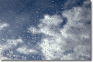
Weather Topic: What is Drizzle?
Home - Education - Precipitation - Drizzle
 Next Topic: Evaporation
Drizzle is precipitation in the form of water droplets which are
smaller than raindrops.
Drizzle is characterized by fine, gently falling droplets and typically does not
impact human habitation in a negative way. The exception to this is freezing drizzle,
a condition where drizzle freezes immediately upon reaching earth's surface.
Freezing drizzle is still less dangerous than freezing rain, but can
potentially result in hazardous road conditions.
Next Topic: Evaporation
Current conditions powered by WeatherAPI.com


