Weather Alert in Texas
Severe Thunderstorm Warning issued August 3 at 1:03PM CDT until August 3 at 2:00PM CDT by NWS Fort Worth TX
AREAS AFFECTED: Collin, TX; Dallas, TX; Denton, TX; Tarrant, TX
DESCRIPTION: SVRFWD The National Weather Service in Fort Worth has issued a * Severe Thunderstorm Warning for... Southeastern Denton County in north central Texas... Eastern Tarrant County in north central Texas... Southwestern Collin County in north central Texas... Northwestern Dallas County in north central Texas... * Until 200 PM CDT. * At 103 PM CDT, a severe thunderstorm was located near Grapevine, moving southeast at 20 mph. HAZARD...60 mph wind gusts and penny size hail. SOURCE...Radar indicated. IMPACT...Expect damage to roofs, siding, and trees. * This severe thunderstorm will be near... Dallas, Irving, Grapevine, Coppell, Southlake, and DFW Intl Airport around 110 PM CDT. Euless around 115 PM CDT. Grand Prairie around 130 PM CDT. Cockrell Hill around 145 PM CDT. Other locations impacted by this severe thunderstorm include White Rock Lake, Joe Pool Lake, Mountain Creek Lake, Buckingham, Grapevine Lake, Lewisville Lake, and Westlake. This includes the following highways... Interstate 35E between mile markers 423 and 454. Interstate 20 between mile markers 451 and 462. Interstate 30 between mile markers 27 and 49. Interstate 45 near mile marker 284.
INSTRUCTION: For your protection get inside a sturdy structure and stay away from windows. Continuous cloud to ground lightning is occurring with this storm. Move indoors immediately. Lightning can kill. Heavy rainfall is occurring with this storm, and may lead to flash flooding. Do not drive your vehicle through flooded roadways.
Want more detail? Get the Complete 7 Day and Night Detailed Forecast!
Current U.S. National Radar--Current
The Current National Weather Radar is shown below with a UTC Time (subtract 5 hours from UTC to get Eastern Time).

National Weather Forecast--Current
The Current National Weather Forecast and National Weather Map are shown below.

National Weather Forecast for Tomorrow
Tomorrow National Weather Forecast and Tomorrow National Weather Map are show below.

North America Water Vapor (Moisture)
This map shows recent moisture content over North America. Bright and colored areas show high moisture (ie, clouds); brown indicates very little moisture present; black indicates no moisture.

Weather Topic: What is Precipitation?
Home - Education - Precipitation - Precipitation
 Next Topic: Rain
Precipitation can refer to many different forms of water that
may fall from clouds. Precipitation occurs after a cloud has become saturated to
the point where its water particles are more dense than the air below the cloud.
In most cases, precipitation will reach the ground, but it is not uncommon for
precipitation to evaporate before it reaches the earth's surface.
When precipitation evaporates before it contacts the ground it is called Virga.
Graupel, hail, sleet, rain, drizzle, and snow are forms of precipitation, but fog
and mist are not considered precipitation because the water vapor which
constitutes them isn't dense enough to fall to the ground.
Next Topic: Rain
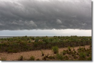
Weather Topic: What are Shelf Clouds?
Home - Education - Cloud Types - Shelf Clouds
 Next Topic: Sleet
A shelf cloud is similar to a wall cloud, but forms at the front
of a storm cloud, instead of at the rear, where wall clouds form.
A shelf cloud is caused by a series of events set into motion by the advancing
storm; first, cool air settles along the ground where precipitation has just fallen.
As the cool air is brought in, the warmer air is displaced, and rises above it,
because it is less dense. When the warmer air reaches the bottom of the storm cloud,
it begins to cool again, and the resulting condensation is a visible shelf cloud.
Next Topic: Sleet
Current conditions powered by WeatherAPI.com


