Weather Alert in Arizona
Severe Thunderstorm Warning issued September 12 at 4:14PM MST until September 12 at 5:00PM MST by NWS Tucson AZ
AREAS AFFECTED: Cochise, AZ; Graham, AZ
DESCRIPTION: SVRTWC The National Weather Service in Tucson has issued a * Severe Thunderstorm Warning for... North Central Cochise County in southeastern Arizona... Southeastern Graham County in southeastern Arizona... * Until 500 PM MST. * At 414 PM MST, severe thunderstorms were located along a line from near Willcox to 15 miles south of San Jose, moving north at 25 mph. HAZARD...Ping pong ball size hail and 60 mph wind gusts. SOURCE...Radar indicated. IMPACT...People and animals outdoors will be injured. Expect hail damage to roofs, siding, windows, and vehicles. Expect wind damage to roofs, siding, and trees. * Locations impacted include... Bowie, Roper Lake State Park and Swift Trail Junction. This includes the following highways... Route 191 between mile markers 88 and 116. Route 266 between mile markers 105 and 114. Interstate 10 between mile markers 343 and 365.
INSTRUCTION: Seek shelter inside a well-built structure and stay away from windows. These storms are capable of producing damaging winds and large hail. Torrential rainfall is also occurring with these storms and may lead to flash flooding. Do not drive your vehicle through flooded roadways.
Want more detail? Get the Complete 7 Day and Night Detailed Forecast!
Current U.S. National Radar--Current
The Current National Weather Radar is shown below with a UTC Time (subtract 5 hours from UTC to get Eastern Time).

National Weather Forecast--Current
The Current National Weather Forecast and National Weather Map are shown below.

National Weather Forecast for Tomorrow
Tomorrow National Weather Forecast and Tomorrow National Weather Map are show below.

North America Water Vapor (Moisture)
This map shows recent moisture content over North America. Bright and colored areas show high moisture (ie, clouds); brown indicates very little moisture present; black indicates no moisture.

Weather Topic: What is Condensation?
Home - Education - Precipitation - Condensation
 Next Topic: Contrails
Condensation is the process which creates clouds, and therefore
it is a crucial process in the water cycle.
Condensation is the change of matter from a state of gas into a state of liquid,
and it happens because water molecules release heat into the atmosphere and
become organized into a more closely packed structure, what we might see as
water droplets.
Water is always present in the air around us as a vapor, but it's too small for
us to see. When water undergoes the process of condensation it becomes organized
into visible water droplets. You've probably seen condensation happen before on the
surface of a cold drink!
Next Topic: Contrails
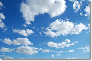
Weather Topic: What are Cumulonimbus Clouds?
Home - Education - Cloud Types - Cumulonimbus Clouds
 Next Topic: Cumulus Clouds
The final form taken by a growing cumulus cloud is the
cumulonimbus cloud, which is very tall and dense.
The tower of a cumulonimbus cloud can soar 23 km into the atmosphere, although
most commonly they stop growing at an altitude of 6 km.
Even small cumulonimbus clouds appear very large in comparison to other cloud types.
They can signal the approach of stormy weather, such as thunderstorms or blizzards.
Next Topic: Cumulus Clouds
Current conditions powered by WeatherAPI.com


