Weather Alert in Texas
Severe Thunderstorm Warning issued April 29 at 6:48PM CDT until April 29 at 7:45PM CDT by NWS San Angelo TX
AREAS AFFECTED: Haskell, TX; Throckmorton, TX
DESCRIPTION: SVRSJT The National Weather Service in San Angelo has issued a * Severe Thunderstorm Warning for... Northeastern Haskell County in west central Texas... Northern Throckmorton County in west central Texas... * Until 745 PM CDT. * At 648 PM CDT, a severe thunderstorm was located near Us-277 Near The Haskell-Knox County Line, or near Weinert, moving east at 35 mph. HAZARD...70 mph wind gusts and half dollar size hail. SOURCE...Radar indicated. IMPACT...Hail damage to vehicles is expected. Expect considerable tree damage. Wind damage is also likely to mobile homes, roofs, and outbuildings. * This severe thunderstorm will be near... Millers Creek Reservoir around 655 PM CDT. Elbert around 740 PM CDT. Other locations impacted by this severe thunderstorm include Us- 277 Near The Haskell-Knox County Line and Us- 183 Near The Throckmorton-Baylor County Line.
INSTRUCTION: For your protection move to an interior room on the lowest floor of a building. A Tornado Watch remains in effect until 100 AM CDT for west central Texas.
Want more detail? Get the Complete 7 Day and Night Detailed Forecast!
Current U.S. National Radar--Current
The Current National Weather Radar is shown below with a UTC Time (subtract 5 hours from UTC to get Eastern Time).

National Weather Forecast--Current
The Current National Weather Forecast and National Weather Map are shown below.

National Weather Forecast for Tomorrow
Tomorrow National Weather Forecast and Tomorrow National Weather Map are show below.

North America Water Vapor (Moisture)
This map shows recent moisture content over North America. Bright and colored areas show high moisture (ie, clouds); brown indicates very little moisture present; black indicates no moisture.

Weather Topic: What are Cumulus Clouds?
Home - Education - Cloud Types - Cumulus Clouds
 Next Topic: Drizzle
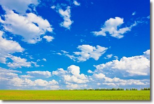
Cumulus clouds are fluffy and textured with rounded tops, and
may have flat bottoms. The border of a cumulus cloud
is clearly defined, and can have the appearance of cotton or cauliflower.
Cumulus clouds form at low altitudes (rarely above 2 km) but can grow very tall,
becoming cumulus congestus and possibly the even taller cumulonimbus clouds.
When cumulus clouds become taller, they have a greater chance of producing precipitation.
Next Topic: Drizzle
Weather Topic: What is Evaporation?
Home - Education - Precipitation - Evaporation
 Next Topic: Fog
Evaporation is the process which returns water from the earth
back to the atmosphere, and is another crucial process in the water cycle.
Evaporation is the transformation of liquid into gas, and it happens because
molecules are excited by the application of energy and turn into vapor.
In order for water to evaporate it has to be on the surface of a body of water.
Next Topic: Fog
Current conditions powered by WeatherAPI.com


