Weather Alert in Indiana
Flood Watch issued March 4 at 3:31AM EST until March 4 at 10:00AM EST by NWS Indianapolis IN
AREAS AFFECTED: Parke; Putnam; Hendricks; Marion; Hancock; Henry; Vigo; Clay; Owen; Morgan; Johnson; Shelby; Rush; Sullivan; Greene; Monroe; Brown; Bartholomew; Decatur; Knox; Daviess; Martin; Lawrence; Jackson; Jennings
DESCRIPTION: * WHAT...Flooding caused by excessive rainfall continues to be possible. * WHERE...Portions of central, east central, south central, southeast, southwest, and west central Indiana, including the following counties, in central Indiana, Bartholomew, Decatur, Hancock, Hendricks, Johnson, Marion, Morgan, Rush and Shelby. In east central Indiana, Henry. In south central Indiana, Brown, Jackson, Lawrence and Monroe. In southeast Indiana, Jennings. In southwest Indiana, Daviess, Greene, Knox, Martin and Sullivan. In west central Indiana, Clay, Owen, Parke, Putnam and Vigo. * WHEN...Until 10 AM EST this morning. * IMPACTS...Excessive runoff may result in flooding of rivers, creeks, streams, and other low-lying and flood-prone locations. Creeks and streams may rise out of their banks. * ADDITIONAL DETAILS... - Rainfall amounts through Wednesday morning are expected to generally be between 2 and 4 inches with the potential for locally higher amounts. - http://www.weather.gov/safety/flood
INSTRUCTION: You should monitor later forecasts and be alert for possible Flood Warnings. Those living in areas prone to flooding should be prepared to take action should flooding develop.
Want more detail? Get the Complete 7 Day and Night Detailed Forecast!
Current U.S. National Radar--Current
The Current National Weather Radar is shown below with a UTC Time (subtract 5 hours from UTC to get Eastern Time).

National Weather Forecast--Current
The Current National Weather Forecast and National Weather Map are shown below.

National Weather Forecast for Tomorrow
Tomorrow National Weather Forecast and Tomorrow National Weather Map are show below.

North America Water Vapor (Moisture)
This map shows recent moisture content over North America. Bright and colored areas show high moisture (ie, clouds); brown indicates very little moisture present; black indicates no moisture.

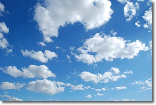
Weather Topic: What are Cumulonimbus Clouds?
Home - Education - Cloud Types - Cumulonimbus Clouds
 Next Topic: Cumulus Clouds
The final form taken by a growing cumulus cloud is the
cumulonimbus cloud, which is very tall and dense.
The tower of a cumulonimbus cloud can soar 23 km into the atmosphere, although
most commonly they stop growing at an altitude of 6 km.
Even small cumulonimbus clouds appear very large in comparison to other cloud types.
They can signal the approach of stormy weather, such as thunderstorms or blizzards.
Next Topic: Cumulus Clouds
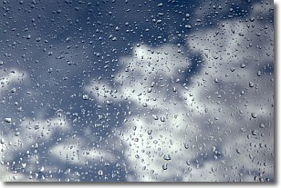
Weather Topic: What is Drizzle?
Home - Education - Precipitation - Drizzle
 Next Topic: Evaporation
Drizzle is precipitation in the form of water droplets which are
smaller than raindrops.
Drizzle is characterized by fine, gently falling droplets and typically does not
impact human habitation in a negative way. The exception to this is freezing drizzle,
a condition where drizzle freezes immediately upon reaching earth's surface.
Freezing drizzle is still less dangerous than freezing rain, but can
potentially result in hazardous road conditions.
Next Topic: Evaporation
Current conditions powered by WeatherAPI.com


