Weather Alert in Idaho
Special Weather Statement issued September 10 at 10:04PM PDT by NWS Spokane WA
AREAS AFFECTED: Idaho Palouse; Central Panhandle Mountains; Northeast Blue Mountains; Lower Garfield and Asotin Counties; Washington Palouse; Upper Columbia Basin
DESCRIPTION: At 1003 PM PDT, Doppler radar was tracking a cluster of strong thunderstorms along a line extending from 11 miles south of St. Maries to 6 miles west of Pullman to 11 miles northeast of Ski Bluewood. Movement was west at 40 mph. HAZARD...Wind gusts up to 50 mph. SOURCE...Radar indicated. IMPACT...Gusty winds could knock down tree limbs and blow around unsecured objects. Locations impacted include... Pullman, Colfax, Pomeroy, Potlatch, Palouse, Tekoa, Garfield, Albion, Oakesdale, Endicott, Onaway, Farmington, Tensed, Riparia, Hay, Dodge, Steptoe, Belmont, La Crosse, and Almota. This includes the following highways... U.S. Highway 95 in Idaho between mile markers 351 and 391. U.S. Highway 12 in Washington between mile markers 389 and 411. U.S. Highway 195 in Washington between mile markers 20 and 57.
INSTRUCTION: If outdoors, consider seeking shelter inside a building.
Want more detail? Get the Complete 7 Day and Night Detailed Forecast!
Current U.S. National Radar--Current
The Current National Weather Radar is shown below with a UTC Time (subtract 5 hours from UTC to get Eastern Time).

National Weather Forecast--Current
The Current National Weather Forecast and National Weather Map are shown below.

National Weather Forecast for Tomorrow
Tomorrow National Weather Forecast and Tomorrow National Weather Map are show below.

North America Water Vapor (Moisture)
This map shows recent moisture content over North America. Bright and colored areas show high moisture (ie, clouds); brown indicates very little moisture present; black indicates no moisture.

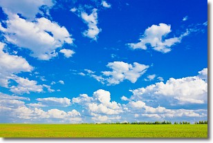
Weather Topic: What are Cumulus Clouds?
Home - Education - Cloud Types - Cumulus Clouds
 Next Topic: Drizzle
Cumulus clouds are fluffy and textured with rounded tops, and
may have flat bottoms. The border of a cumulus cloud
is clearly defined, and can have the appearance of cotton or cauliflower.
Cumulus clouds form at low altitudes (rarely above 2 km) but can grow very tall,
becoming cumulus congestus and possibly the even taller cumulonimbus clouds.
When cumulus clouds become taller, they have a greater chance of producing precipitation.
Next Topic: Drizzle
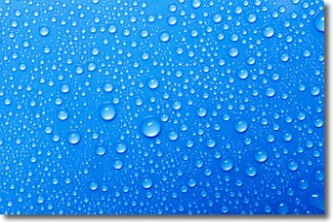
Weather Topic: What is Evaporation?
Home - Education - Precipitation - Evaporation
 Next Topic: Fog
Evaporation is the process which returns water from the earth
back to the atmosphere, and is another crucial process in the water cycle.
Evaporation is the transformation of liquid into gas, and it happens because
molecules are excited by the application of energy and turn into vapor.
In order for water to evaporate it has to be on the surface of a body of water.
Next Topic: Fog
Current conditions powered by WeatherAPI.com


