Weather Alert in Oregon
Air Stagnation Advisory issued February 5 at 8:53PM PST until February 6 at 10:00PM PST by NWS Portland OR
AREAS AFFECTED: Lower Columbia River; East Central Willamette Valley; Benton County Lowlands; Linn County Lowlands; Lane County Lowlands; Clackamas County Cascade Foothills; Cascade Foothills of Marion and Linn Counties; Lane County Cascade Foothills; Cowlitz County Lowlands; North Clark County Lowlands
DESCRIPTION: * WHAT...Light winds and limited air movement will lead to a period of stagnant air conditions. * WHERE...South Willamette Valley, Foothills of the Northern and Central Oregon Cascades, Lower Columbia River and Cowlitz River Valleys, East Central Willamette Valley, and North Clark County Lowlands. * WHEN...Until 10 PM PST Friday. * IMPACTS...Deteriorating air quality may cause issues for people with respiratory problems.
INSTRUCTION: State air quality agencies highly recommend that no outdoor burning occur and that residential wood burning devices be limited as much as possible. According to state air quality agencies, prolonged periods of stagnant air can hold pollutants close to the ground where people live and breathe. Check with your local burn agency for any current restrictions in your area. People with respiratory illness should follow their physician's advice for dealing with high levels of air pollution during periods of stagnant air, especially if an Air Quality Alert is in effect for your area. To see if an Air Quality Alert is in effect for your area, go to www.weather.gov/pqr and left-click your location on the homepage map display. Alternatively, you could also type your location into the search bar found on the top-left hand side of the homepage. From there, you will see an Air Quality Alert listed at the top if one is in effect for your location; you can click the alert to read more details if applicable.
Want more detail? Get the Complete 7 Day and Night Detailed Forecast!
Current U.S. National Radar--Current
The Current National Weather Radar is shown below with a UTC Time (subtract 5 hours from UTC to get Eastern Time).

National Weather Forecast--Current
The Current National Weather Forecast and National Weather Map are shown below.

National Weather Forecast for Tomorrow
Tomorrow National Weather Forecast and Tomorrow National Weather Map are show below.

North America Water Vapor (Moisture)
This map shows recent moisture content over North America. Bright and colored areas show high moisture (ie, clouds); brown indicates very little moisture present; black indicates no moisture.

Weather Topic: What are Cirrus Clouds?
Home - Education - Cloud Types - Cirrus Clouds
 Next Topic: Condensation
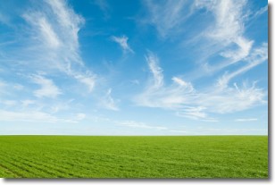
Cirrus clouds are high-level clouds that occur above 20,000 feet
and are composed mainly of ice crystals.
They are thin and wispy in appearance.
What do they indicate?
They are often the first sign of an approaching storm.
Next Topic: Condensation
Weather Topic: What are Contrails?
Home - Education - Cloud Types - Contrails
 Next Topic: Cumulonimbus Clouds
A contrail is an artificial cloud, created by the passing of an
aircraft.
Contrails form because water vapor in the exhaust of aircraft engines is suspended
in the air under certain temperatures and humidity conditions. These contrails
are called exhaust contrails.
Another type of contrail can form due to a temporary reduction in air pressure
moving over the plane's surface, causing condensation.
These are called aerodynamic contrails.
When you can see your breath on a cold day, it is also because of condensation.
The reason contrails last longer than the condensation from your breath is
because the water in contrails freezes into ice particles.
Next Topic: Cumulonimbus Clouds
Current conditions powered by WeatherAPI.com


