Weather Alert in Texas
Special Weather Statement issued August 3 at 1:01PM CDT by NWS Fort Worth TX
AREAS AFFECTED: Denton; Collin; Tarrant; Dallas; Johnson; Ellis
DESCRIPTION: At 100 PM CDT, Doppler radar was tracking strong thunderstorms along a line extending from near Prosper to near Godley. Movement was southeast at 20 mph. HAZARD...Wind gusts up to 50 mph and pea size hail. SOURCE...Radar indicated. IMPACT...Gusty winds could knock down tree limbs and blow around unsecured objects. Minor damage to outdoor objects is possible. Strong thunderstorms will be near... Dallas, Fort Worth, Arlington, Irving, Carrollton, Frisco, Lewisville, Flower Mound, Euless, and Bedford around 105 PM CDT. Plano, Grand Prairie, McKinney, Mansfield, and Keene around 110 PM CDT. Farmers Branch around 115 PM CDT. Allen and Addison around 120 PM CDT. Alvarado around 125 PM CDT. Other locations impacted by these storms include Lake Arlington, Rio Vista, Parker, Joe Pool Lake, Mountain Creek Lake, Sand Flat, Egan, Lillian, Lewisville Lake, and New Hope. This includes the following highways... Interstate 35W between mile markers 17 and 49. Interstate 35E between mile markers 428 and 456. Interstate 20 between mile markers 435 and 461. Interstate 30 between mile markers 17 and 44.
INSTRUCTION: If outdoors, consider seeking shelter inside a building. Torrential rainfall is also occurring with these storms and may lead to localized flooding. Do not drive your vehicle through flooded roadways. Frequent cloud to ground lightning is occurring with these storms. Lightning can strike 10 miles away from a thunderstorm. Seek a safe shelter inside a building or vehicle.
Want more detail? Get the Complete 7 Day and Night Detailed Forecast!
Current U.S. National Radar--Current
The Current National Weather Radar is shown below with a UTC Time (subtract 5 hours from UTC to get Eastern Time).

National Weather Forecast--Current
The Current National Weather Forecast and National Weather Map are shown below.

National Weather Forecast for Tomorrow
Tomorrow National Weather Forecast and Tomorrow National Weather Map are show below.

North America Water Vapor (Moisture)
This map shows recent moisture content over North America. Bright and colored areas show high moisture (ie, clouds); brown indicates very little moisture present; black indicates no moisture.

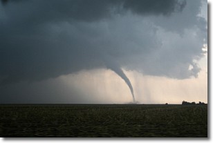
Weather Topic: What are Wall Clouds?
Home - Education - Cloud Types - Wall Clouds
 Next Topic: Altocumulus Clouds
A wall cloud forms underneath the base of a cumulonimbus cloud,
and can be a hotbed for deadly tornadoes.
Wall clouds are formed by air flowing into the cumulonimbus clouds, which can
result in the wall cloud descending from the base of the cumulonimbus cloud, or
rising fractus clouds which join to the base of the storm cloud as the wall cloud
takes shape.
Wall clouds can be very large, and in the Northern Hemisphere they generally
form at the southern edge of cumulonimbus clouds.
Next Topic: Altocumulus Clouds
Weather Topic: What are Altostratus Clouds?
Home - Education - Cloud Types - Altostratus Clouds
 Next Topic: Cirrocumulus Clouds
Altostratus clouds form at mid to high-level altitudes
(between 2 and 7 km) and are created by a warm, stable air mass which causes
water vapor
to condense as it rise through the atmosphere. Usually altostratus clouds are
featureless sheets characterized by a uniform color.
In some cases, wind punching through the cloud formation may give it a waved
appearance, called altostratus undulatus. Altostratus clouds
are commonly seen with other cloud formations accompanying them.
Next Topic: Cirrocumulus Clouds
Current conditions powered by WeatherAPI.com


