Weather Alert in New Mexico
Flood Watch issued September 12 at 3:24AM MDT until September 13 at 12:00AM MDT by NWS Albuquerque NM
AREAS AFFECTED: Northwest Plateau; Far Northwest Highlands; Northwest Highlands; West Central Mountains; West Central Highlands; Tusas Mountains Including Chama; Jemez Mountains; Glorieta Mesa Including Glorieta Pass; Northern Sangre de Cristo Mountains; Southern Sangre de Cristo Mountains; East Slopes Sangre de Cristo Mountains; Upper Rio Grande Valley; Espanola Valley; Santa Fe Metro Area; Middle Rio Grande Valley/Albuquerque Metro Area; Sandia/Manzano Mountains Including Edgewood
DESCRIPTION: * WHAT...Flash flooding caused by excessive rainfall continues to be possible. * WHERE...Portions of central, north central, northwest, and west central New Mexico, including the following areas, in central New Mexico, Middle Rio Grande Valley including the Albuquerque Metro Area and Sandia and Manzano Mountains including Edgewood. In north central New Mexico, East Slopes Sangre de Cristo Mountains, Espanola Valley, Far Northwest Highlands, Glorieta Mesa Including Glorieta Pass, Jemez Mountains, Northern Sangre de Cristo Mountains, Northwest Highlands, Santa Fe Metro Area, Southern Sangre de Cristo Mountains, Tusas Mountains Including Chama and Upper Rio Grande Valley. In northwest New Mexico, Northwest Plateau. In west central New Mexico, West Central Highlands and West Central Mountains. * WHEN...From 10 AM MDT this morning through this evening. * IMPACTS...Excessive runoff may result in flooding of rivers, creeks, streams, and other low-lying and flood-prone locations. Creeks and streams may rise out of their banks. Flooding may occur in poor drainage and urban areas. Low-water crossings may be flooded. Storm drains and ditches may become clogged with debris. * ADDITIONAL DETAILS... - Multiple rounds of showers and thunderstorms are forecast today and this evening as a disturbance crosses. Stronger storms will be capable of producing torrential rainfall at rates over 1-2 inches per hour. Some locations are likely to receive over 2 inches of rain, and over 3 inches in a few spots. Recent burn scars, urban areas, canyons, arroyos, and other low lying areas have the greatest risk of flash flooding. Flood waters in arroyos may travel miles to reach your location, so stay out! - http://www.weather.gov/safety/flood
INSTRUCTION: You should monitor later forecasts and be prepared to take action should Flash Flood Warnings be issued. Turn around, don't drown when encountering flooded roads. Most flood deaths occur in vehicles.
Want more detail? Get the Complete 7 Day and Night Detailed Forecast!
Current U.S. National Radar--Current
The Current National Weather Radar is shown below with a UTC Time (subtract 5 hours from UTC to get Eastern Time).

National Weather Forecast--Current
The Current National Weather Forecast and National Weather Map are shown below.

National Weather Forecast for Tomorrow
Tomorrow National Weather Forecast and Tomorrow National Weather Map are show below.

North America Water Vapor (Moisture)
This map shows recent moisture content over North America. Bright and colored areas show high moisture (ie, clouds); brown indicates very little moisture present; black indicates no moisture.

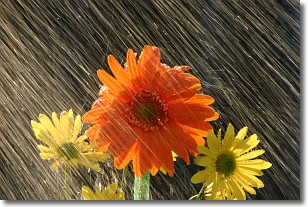
Weather Topic: What is Rain?
Home - Education - Precipitation - Rain
 Next Topic: Shelf Clouds
Precipitation in the form of water droplets is called rain.
Rain generally has a tendency to fall with less intensity over a greater period
of time, and when rainfall is more severe it is usually less sustained.
Rain is the most common form of precipitation and happens with greater frequency
depending on the season and regional influences. Cities have been shown to have
an observable effect on rainfall, due to an effect called the urban heat island.
Compared to upwind, monthly rainfall between twenty and forty miles downwind of
cities is 30% greater.
Next Topic: Shelf Clouds
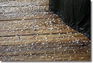
Weather Topic: What is Sleet?
Home - Education - Precipitation - Sleet
 Next Topic: Snow
Sleet is a form of precipitation in which small ice pellets are the primary
components. These ice pellets are smaller and more translucent than hailstones,
and harder than graupel. Sleet is caused by specific atmospheric conditions and
therefore typically doesn't last for extended periods of time.
The condition which leads to sleet formation requires a warmer body of air to be
wedged in between two sub-freezing bodies of air. When snow falls through a warmer
layer of air it melts, and as it falls through the next sub-freezing body of air
it freezes again, forming ice pellets known as sleet. In some cases, water
droplets don't have time to freeze before reaching the surface and the result is
freezing rain.
Next Topic: Snow
Current conditions powered by WeatherAPI.com


