Weather Alert in Pennsylvania
Winter Weather Advisory issued February 5 at 9:57PM EST until February 7 at 1:00AM EST by NWS Cleveland OH
AREAS AFFECTED: Southern Erie
DESCRIPTION: * WHAT...Snow expected. Total snow accumulations between 3 and 5 inches. Winds gusting as high as 40 mph may will produce patchy to areas of blowing snow Friday evening. * WHERE...Southern Erie County. * WHEN...From 7 AM Friday to 1 AM EST Saturday. * IMPACTS...Plan on slippery conditions with with slower travel likely The hazardous conditions could impact the Friday morning and evening commutes. Blowing snow may reduce visibility less than a mile at times. * ADDITIONAL DETAILS...A broken line of snow squalls or heavier burst of snow may develop along an Arctic front as it pushes through the area Friday evening.
INSTRUCTION: Slow down and use caution while traveling. The Pennsylvania Department of Transportation and Pennsylvania Turnpike Commission strongly encourage motorists to heed all travel restrictions and delay unnecessary travel. Visit www.511pa.com for the latest travel, roadway, and traffic conditions.
Want more detail? Get the Complete 7 Day and Night Detailed Forecast!
Current U.S. National Radar--Current
The Current National Weather Radar is shown below with a UTC Time (subtract 5 hours from UTC to get Eastern Time).

National Weather Forecast--Current
The Current National Weather Forecast and National Weather Map are shown below.

National Weather Forecast for Tomorrow
Tomorrow National Weather Forecast and Tomorrow National Weather Map are show below.

North America Water Vapor (Moisture)
This map shows recent moisture content over North America. Bright and colored areas show high moisture (ie, clouds); brown indicates very little moisture present; black indicates no moisture.

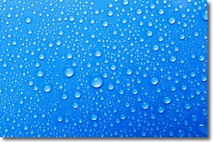
Weather Topic: What is Evaporation?
Home - Education - Precipitation - Evaporation
 Next Topic: Fog
Evaporation is the process which returns water from the earth
back to the atmosphere, and is another crucial process in the water cycle.
Evaporation is the transformation of liquid into gas, and it happens because
molecules are excited by the application of energy and turn into vapor.
In order for water to evaporate it has to be on the surface of a body of water.
Next Topic: Fog
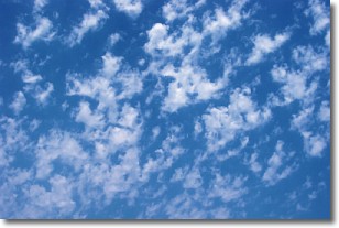
Weather Topic: What are Fractus Clouds?
Home - Education - Cloud Types - Fractus Clouds
 Next Topic: Freezing Rain
A fractus cloud (scud) is a fragmented, tattered cloud which has
likely been sheared off of another cloud. They are accessory clouds, meaning they
develop from parent clouds, and are named in a way which describes the original
cloud which contained them.
Fractus clouds which have originated from cumulus clouds are referred to as
cumulus fractus, while fractus clouds which have originated from stratus clouds
are referred to as stratus fractus. Under certain conditions a fractus cloud might
merge with another cloud, or develop into a cumulus cloud, but usually a
fractus cloud seen by itself will dissipate rapidly.
They are often observed on the leading and trailing edges of storm clouds,
and are a display of wind activity.
Next Topic: Freezing Rain
Current conditions powered by WeatherAPI.com


