Weather Alert in Illinois
Flood Warning issued March 7 at 9:49AM CST until March 8 at 3:00AM CDT by NWS Chicago IL
AREAS AFFECTED: Cook, IL
DESCRIPTION: ...The Flood Warning is extended for the following rivers in Illinois... Thorn Creek at Thornton affecting Cook County. For the Thorn Creek...including Thornton...Minor flooding is forecast. * WHAT...Minor flooding is occurring and minor flooding is forecast. * WHERE...Thorn Creek from Near Glenwood downstream to confluence with Little Calumet River, including the Thornton gauge. * WHEN...Until late tonight. * IMPACTS...At 11.0 feet, 187th Street threatened in Glenwood. * ADDITIONAL DETAILS... - At 9:30 AM CST Saturday the stage was 10.1 feet. - Recent Activity...The maximum river stage in the 24 hours ending at 9:30 AM CST Saturday was 10.1 feet. - Forecast...The river is expected to rise to a crest of 10.1 feet this afternoon. It will then fall below flood stage this evening. - Flood stage is 9.0 feet. - http://www.weather.gov/safety/flood
INSTRUCTION: A Flood Warning means water levels above flood stage are imminent or may already be occurring. Persons along rivers and streams in the warned area should take immediate precautions to protect life and property. Additional information is available at www.weather.gov. The next statement will be issued by late tonight.
Want more detail? Get the Complete 7 Day and Night Detailed Forecast!
Current U.S. National Radar--Current
The Current National Weather Radar is shown below with a UTC Time (subtract 5 hours from UTC to get Eastern Time).

National Weather Forecast--Current
The Current National Weather Forecast and National Weather Map are shown below.

National Weather Forecast for Tomorrow
Tomorrow National Weather Forecast and Tomorrow National Weather Map are show below.

North America Water Vapor (Moisture)
This map shows recent moisture content over North America. Bright and colored areas show high moisture (ie, clouds); brown indicates very little moisture present; black indicates no moisture.

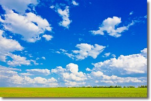
Weather Topic: What are Cumulus Clouds?
Home - Education - Cloud Types - Cumulus Clouds
 Next Topic: Drizzle
Cumulus clouds are fluffy and textured with rounded tops, and
may have flat bottoms. The border of a cumulus cloud
is clearly defined, and can have the appearance of cotton or cauliflower.
Cumulus clouds form at low altitudes (rarely above 2 km) but can grow very tall,
becoming cumulus congestus and possibly the even taller cumulonimbus clouds.
When cumulus clouds become taller, they have a greater chance of producing precipitation.
Next Topic: Drizzle
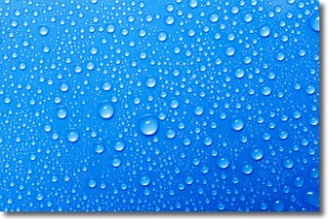
Weather Topic: What is Evaporation?
Home - Education - Precipitation - Evaporation
 Next Topic: Fog
Evaporation is the process which returns water from the earth
back to the atmosphere, and is another crucial process in the water cycle.
Evaporation is the transformation of liquid into gas, and it happens because
molecules are excited by the application of energy and turn into vapor.
In order for water to evaporate it has to be on the surface of a body of water.
Next Topic: Fog
Current conditions powered by WeatherAPI.com


