Weather Alert in Idaho
Special Weather Statement issued September 10 at 9:38PM PDT by NWS Spokane WA
AREAS AFFECTED: Idaho Palouse; Central Panhandle Mountains; Lewiston Area; Lewis and Southern Nez Perce Counties; Northeast Blue Mountains; Lower Garfield and Asotin Counties; Washington Palouse
DESCRIPTION: At 938 PM PDT, Doppler radar was tracking strong thunderstorms along a line extending from 10 miles east of Kendrick to 6 miles southwest of Clarkston Heights-Vineland. Movement was northwest at 20 mph. HAZARD...Winds in excess of 40 mph and pea size hail. SOURCE...Radar indicated. IMPACT...Gusty winds could knock down tree limbs and blow around unsecured objects. Minor hail damage to outdoor objects is possible. Locations impacted include... Lewiston, Pullman, Moscow, Clarkston, Lapwai, Pomeroy, Genesee, Troy, Juliaetta, Deary, Culdesac, Kendrick, Clarkston Heights-Vineland, West Clarkston-Highland, Asotin, Colton, Uniontown, Peck, Reubens, and Spalding. This includes the following highways... U.S. Highway 95 in Idaho between mile markers 281 and 350. U.S. Highway 12 in Idaho between mile markers 0 and 36, and near mile marker 38. U.S. Highway 12 in Washington between mile markers 398 and 434. U.S. Highway 195 in Washington between mile markers 1 and 20.
INSTRUCTION: If outdoors, consider seeking shelter inside a building.
Want more detail? Get the Complete 7 Day and Night Detailed Forecast!
Current U.S. National Radar--Current
The Current National Weather Radar is shown below with a UTC Time (subtract 5 hours from UTC to get Eastern Time).

National Weather Forecast--Current
The Current National Weather Forecast and National Weather Map are shown below.

National Weather Forecast for Tomorrow
Tomorrow National Weather Forecast and Tomorrow National Weather Map are show below.

North America Water Vapor (Moisture)
This map shows recent moisture content over North America. Bright and colored areas show high moisture (ie, clouds); brown indicates very little moisture present; black indicates no moisture.

Weather Topic: What is Drizzle?
Home - Education - Precipitation - Drizzle
 Next Topic: Evaporation
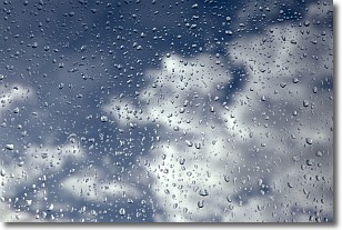
Drizzle is precipitation in the form of water droplets which are
smaller than raindrops.
Drizzle is characterized by fine, gently falling droplets and typically does not
impact human habitation in a negative way. The exception to this is freezing drizzle,
a condition where drizzle freezes immediately upon reaching earth's surface.
Freezing drizzle is still less dangerous than freezing rain, but can
potentially result in hazardous road conditions.
Next Topic: Evaporation
Weather Topic: What is Fog?
Home - Education - Cloud Types - Fog
 Next Topic: Fractus Clouds
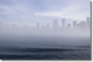
Fog is technically a type of stratus cloud, which lies along the
ground and obscures visibility.
It is usually created when humidity in the air condenses into tiny water droplets.
Because of this, some places are more prone to foggy weather, such as regions
close to a body of water.
Fog is similar to mist; both are the appearance of water droplets suspended in
the air, but fog is the term applied to the condition when visibility is less than 1 km.
Next Topic: Fractus Clouds
Current conditions powered by WeatherAPI.com


